Mojave desert, Clark mountain

Sonja setting out on the little step that blocks access to the summit ridge


Clark Mountain – a remote desert peak.

December 2014: Clark Mountain, at nearly 8000′, is the high point in Mojave National Preserve. It’s a lofty bastion of limestone with a complex topography involving numerous radiating ridges and precipitous basins. The mountain is covered in single leaf pinyon and juniper, plus the typical assortment of prickly desert species on the lower flanks. Several shady canyons on the north side hold huge stands of white fir, a rather uncommon phenomenon in these parts.
While relatively close to Interstate 15 between the Nevada border and Baker, access to Clark’s south side trailhead is a complex affair. An ever evolving mining operation near the freeway exit changes the public right-away on a regular basis, depositing visitors back onto public lands in unexpected places. Add to this the rugged state of the deteriorating network of roads and quite a few hikers have given up even setting foot on the mountain. At the end of the drive is a forgotten relic of a picnic area, amazingly well equipped with unused luxuries, slowly falling into decay. In itself worth a visit.
The occasional steep wall or pinnacles of grey rock rear up along most prospective summit routes, meaning succesful summiteers better come prepared. From the picnic area we picked a well defined, pleasant looking ridge that seemed to rise unbroken to the main divide. The day before our climb on December 14 a furious winter storm had made it in from the Pacific and dropped several inches of snow above 6500′. The blasting winds had formed bizarre ice sculptures along exposed edges and covered the trees in beautiful rime frost.
Once on the summit ridge at 7600′ it became obvious that although almost all the elevation gain had been dispensed with, the more serious portion of the route still remained. Towers of jagged limestone lead to overhanging drops along the complicated arete between us and high point of Clark. We first tried a direct route along the ridge, but iced over holds and wind blown snow put a halt to that. Forgot to mention we also had a dog along!
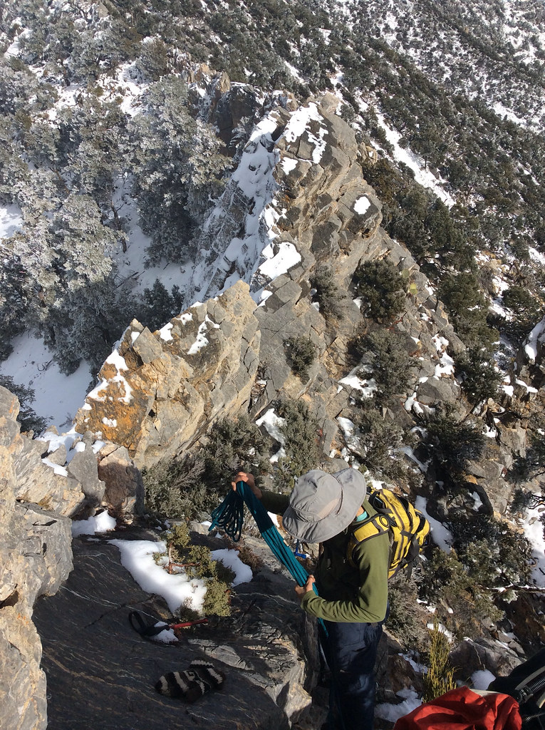
After circumventing several hard section via ups and downs of only slightly milder terrain, we came to a series of walls that very clearly had no bypassing options. The first step, about 40′ tall, needed ropes to get the dog safely up and facilitating later return. After this crux more slow scrambling on snowy ledges with some considerable exposure, still belaying the dog, took us to the final push to the elusive summit.
The register had 4 other parties summiting in 2014, and since 1995 only about 25 pages had been filled out.
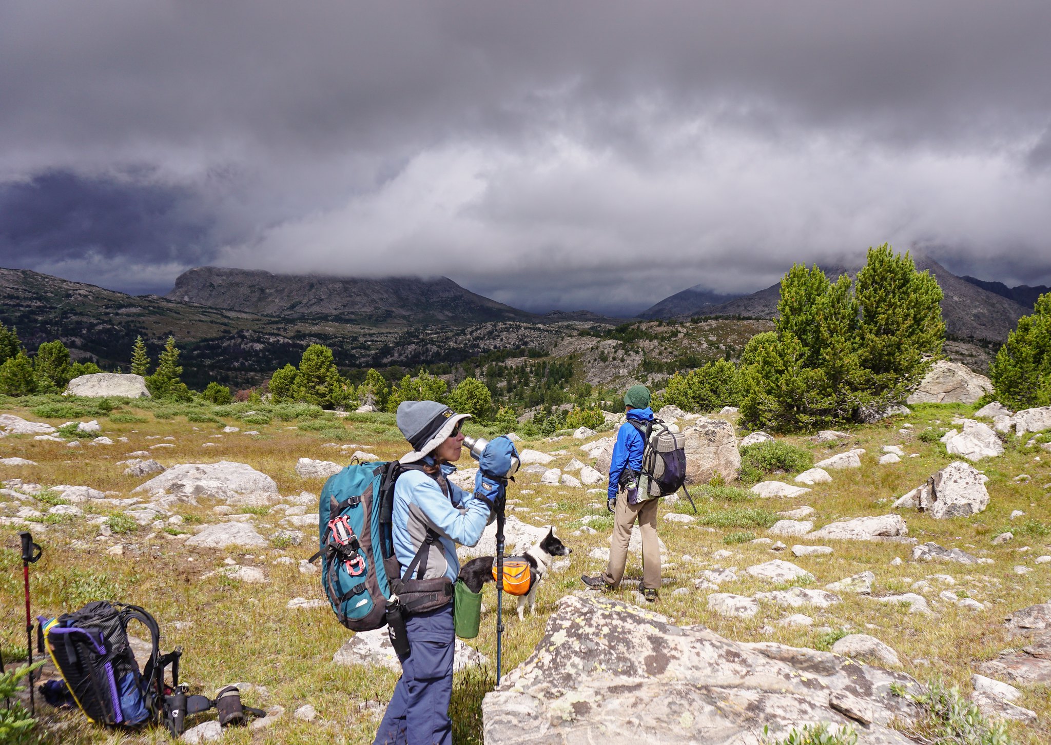
We were nearing the end of a road trip and had no juice left in any of our cameras. As we were leaving the van for the hike we remembered our iPad can take pics too! So here you go:


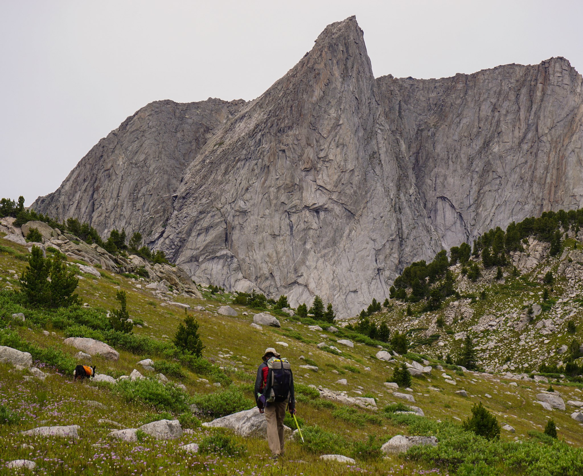
Starting up the lower slopes.


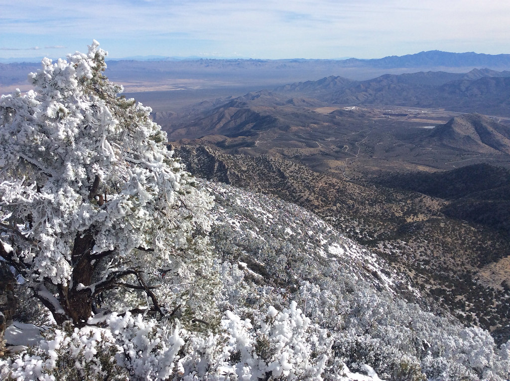
In the distance the mine at the exit off I-15, and the roads leading to the base.


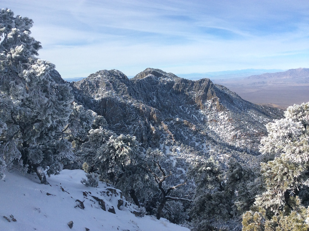
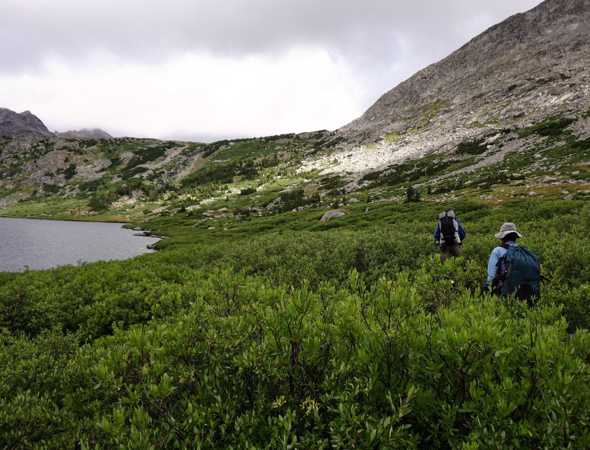
The summit area from the main divide at 7600′.


Discussing route choices after trying one impasse.


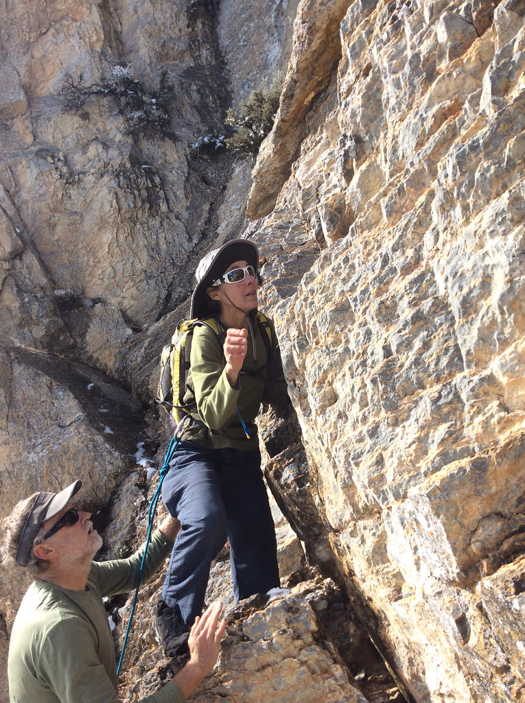
Sonja setting out on the crux passage…


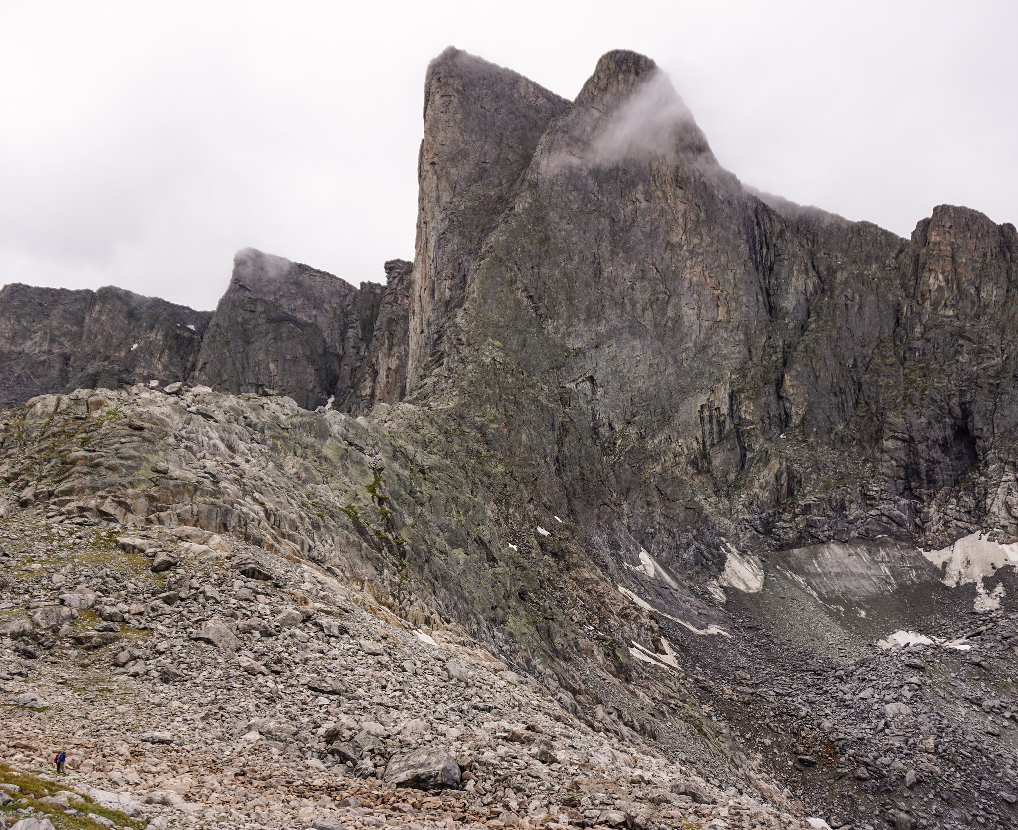
Negotiating towers and pinnacles later on.


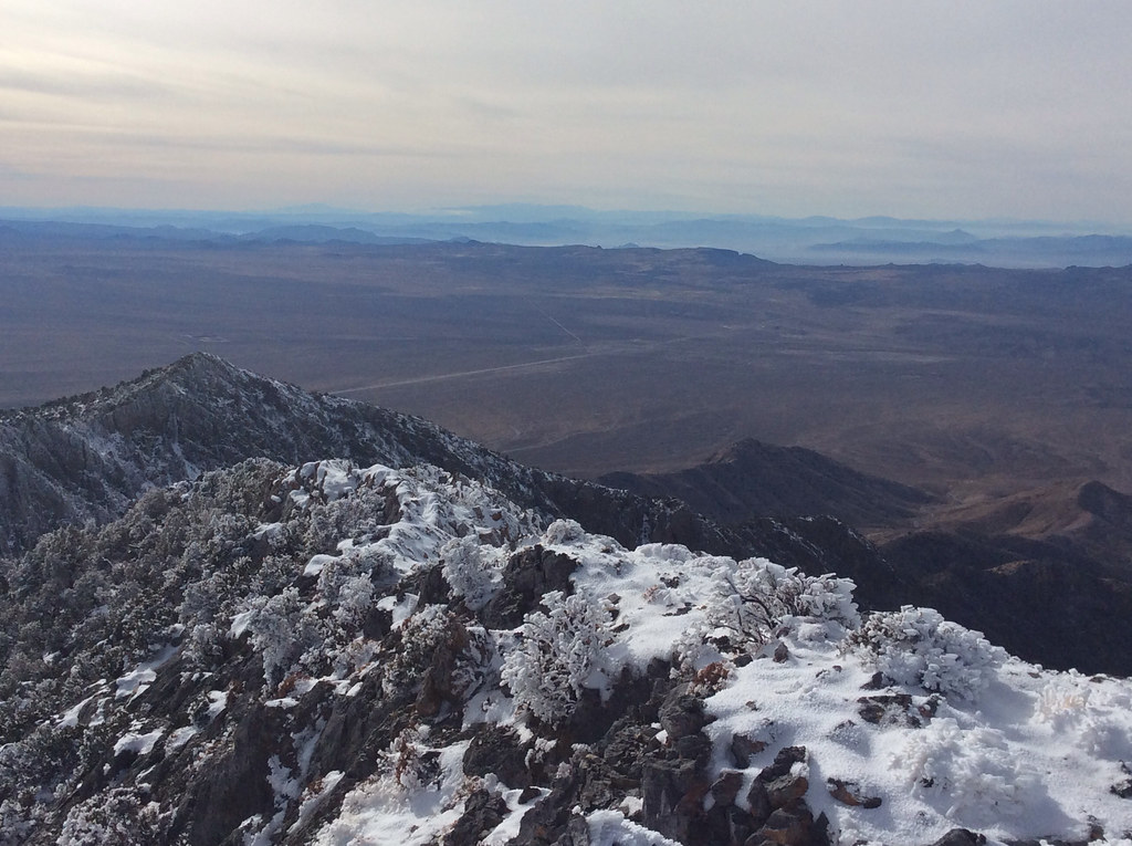
The straight line in the background is the interstate.


In the distance is Mt Charleston west of Las Vegas.


I can’t really not include a pic of our dog on the summit!

wind river high route

Off trail traveling in the Wind River Mountains

Summer 2015.
I’m sure many of you have seen AdventureAlan’s site ( http://www.adventurealan.com/WRHR/ ) profiling a rugged route from Green River Lakes to Big Sandy. Or maybe some of our members have done the trip? Maybe Alan is a poster here?
Either way, we had hardly any experience with the Winds before going to Wyoming for work this summer. Sonja backpacked somewhere in the range 20 years ago. This July we packrafted the upper Green and bagged a peak not far in. What those trips did do was getting us ready for more.
Flawless granite rivaling the Sierra’s, but somehow more sinister and foreboding than the walls found in the Range of Light. Rugged post glaciated basins seemingly straight from the Cascades. And all that goodness mixed with the typical unstable weather patterns of the northern Rockies. A good recipe for attracting our attention.
Fully immersed in work for the month of July, we only had a few hours on the drive to Pinedale to come up with a trip. An Internet search for something else led us to the site mentioned above, and since Alan gives the option to download some reasonably detailed maps to our phone we decided that it probably would serve us well as an introduction to the inner range.
Furious weather was forecasted for day 2 and 3 so we decided to reverse the route and take the hits on the lower middle section instead of the climax of Knife Point Glacier. This worked out as well as 40 mph winds and driving hail and rain can in the backcountry.
Besides that we stuck to Alan’s itinerary. The descriptions and maps from the site are spot on. It took us six days and we camped in the following locations: Shadow Lake, Middle Fork Lake, ‘Crap Camp’ lake, upper Alpine Lake and below the Stroud glacier. The amount of large talus and the efforts to deal with it should not be dismissed. A few of those remote lake traverses are very time consuming and laborious, bordering on expeditions in themselves.
The ice and snow portions obviously vary with the seasons, but currently should go without spikes. We did carry two axes and a set of crampons between the three of us and felt it allowed more freedom in local route choices. The dog had no issues with any of the challenges thrown at him, even with a pack on, but this young hound is spectacularly agile. I would think twice before flat out recommending this route safe for dogs. Again the car sized talus is the issue.
All together a fantastic route. Undoubtedly there’s more remote areas and bigger glaciers elsewhere, especially north and east of Knapsack col, but as a first dig into these attractive mountains we surely were in awe.
Pics in no particular order.
Readying to climb the Knife Point Glacier to Indian Pass, day 5.
Camp under the Stroud Glacier, official source of the Green River.
Dinner at the outlet to Upper Alpine Lake. About as remote and hard to get to mountain location as I’ve been to in many years. Alpine Col, the first goal of the the following morning, in the background.
Stormy and rainy times under Pronghorn Peak, day 3
Camp Lake, from where the complex 6 hour climb to Alpine Col started. Douglas Peak above us.
Day 2, on the way to the first pass after Pyramid Lake. Pre-rain gloom.
image by jan nikolajsen, on Flickr
Not all of the route was high alpine glory. Here bushwhacking rain-soaked willows for seemingly ever along massive Middle Fork Lake.
Featured image for home page:
[ATTACH]33327[/ATTACH]
In the middle third of the route relatively low terrain, 10500-11000′, and few prominent features challenged us a bit with route finding.
Dwarfed below Pronghorn Peak, after crossing a pass with name we never were aware of.
Searching for the 4th class downclimb Alan calls the ‘Exit Crack’. When the correct route was located it turned out to be no big deal.
Siphoning fresh rain water.
After the sun sets at a cold alpine camp, what else do you do but pace impatiently?
Testing my weak arms against super inflated chips bags. Obviously early in the trip while supplies were still plentiful.
At remote Camp Lake, among trees denser than anything on the West side at that elevation.
On day 3 the rain and wind was so cold and miserable that lunch developed into a warming nap session.
Descending the north side of Alpine Col, with the next crossing, Indian pass, visible between Knife Point and Jackson.
Sonja on one of many little steps leading around the more tricky lake traverses. Many times we thought if the extra weight of packrafts would actually be saving us in the long run.
Titcomb Basin
The final climb up to Knapsack Col. The east side is completely without trail but comparatively small talus makes it less of a toil. Which was good, as this was the third 12000’+ pass of day 5.
Bjorn playing with the camera. Dinner sludge.
Trying our luck at hitchhiking after the long trudge out along the Green River. It was late and very few cars were leaving. Eventually a family already cramped in a compact SUV happily squeezed us in.