the maze from millard bottom

The boat and bike.

Solo Maze trip, with a twist.

During a spring 2014 outing to that certain remote part of Canyonlands I combined three non-motorized ways of travel, namely mountain biking, packrafting and hiking. While it sounds complicated at first it turned out remarkably simple both in planning and execution. This was important as I, as usual, conceived the idea to this trip some 36 hours before setting out.


On the river side of the Maze, there’s only one spot where a road leads all the way down to the water: the mouth of Millard Canyon on the Green. It’s directly across from the White Rim road in the Island in the Sky district, near a spot where this road also dips down close to the river.


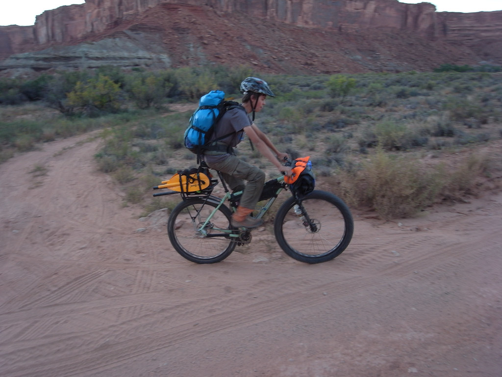
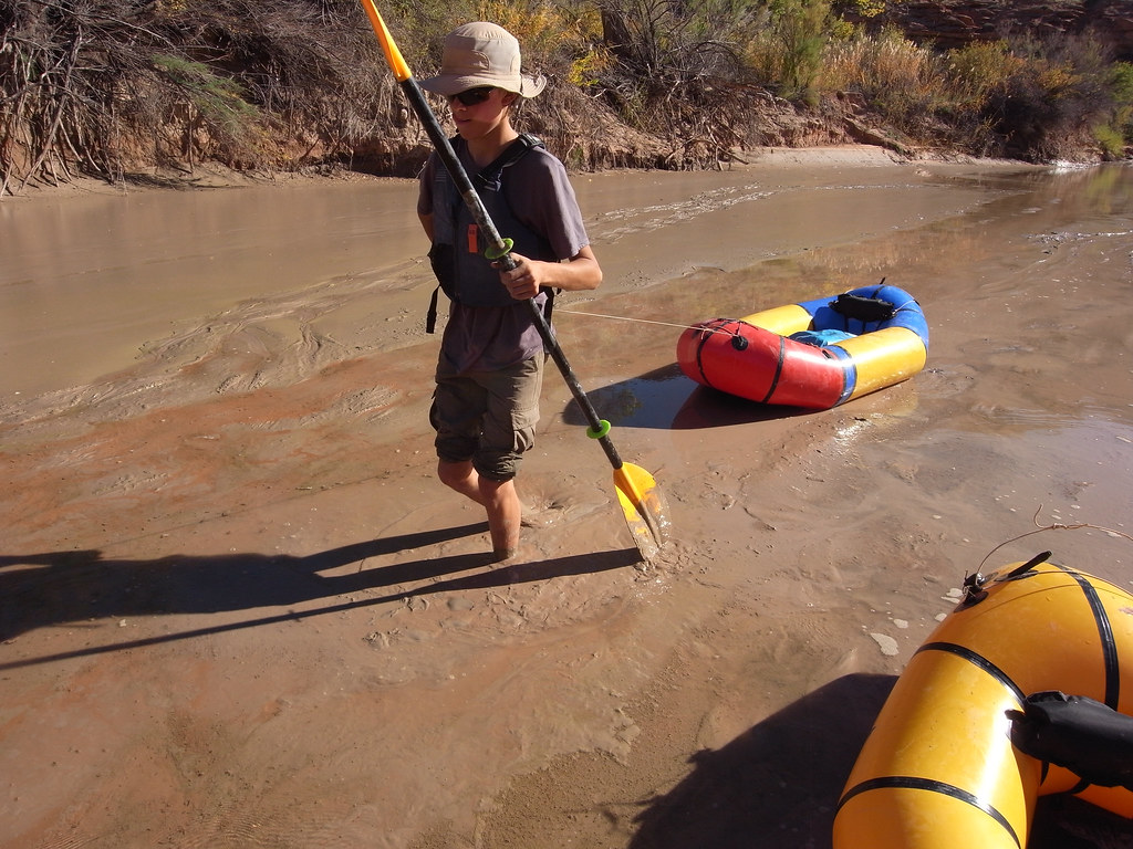
Seeing a potential back door to the Maze not needing 4×4 wheels, jet boats or a long commute to Hans Flat I packed up the bike with some light bivy gear, 3 days of food and a 5 pound Alpacka raft and pedaled out the White Rim. Nearly 10 miles upstream of Millard I launched the boat with the bike and everything and leisurely drifted with the current.


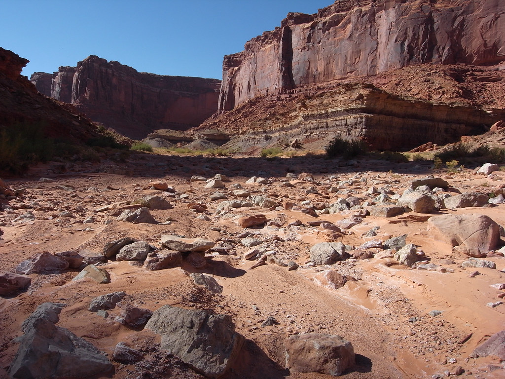
At around noon on day one I pulled up on the beach at Millard and began the 25 mile ride to the Maze Overlook. The huge terrain out here, this early in the year, had a very remote feel to it. It was obvious no vehicles had ventured this far out yet for the 2014 season.


Storm cells, headwind and crusty sand made for a taxing ride. At sundown amidst sprinkles I got to camp and quickly dipped below the rim to a secure rock shelter, out of the wind. Had a beautiful evening and excellent sleep.


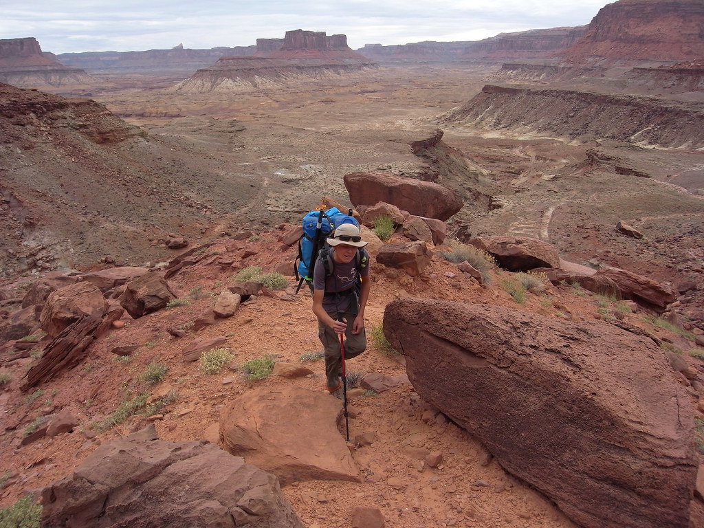
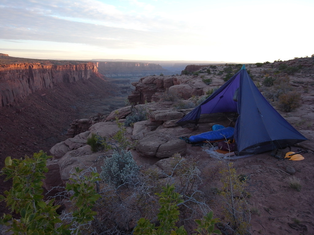
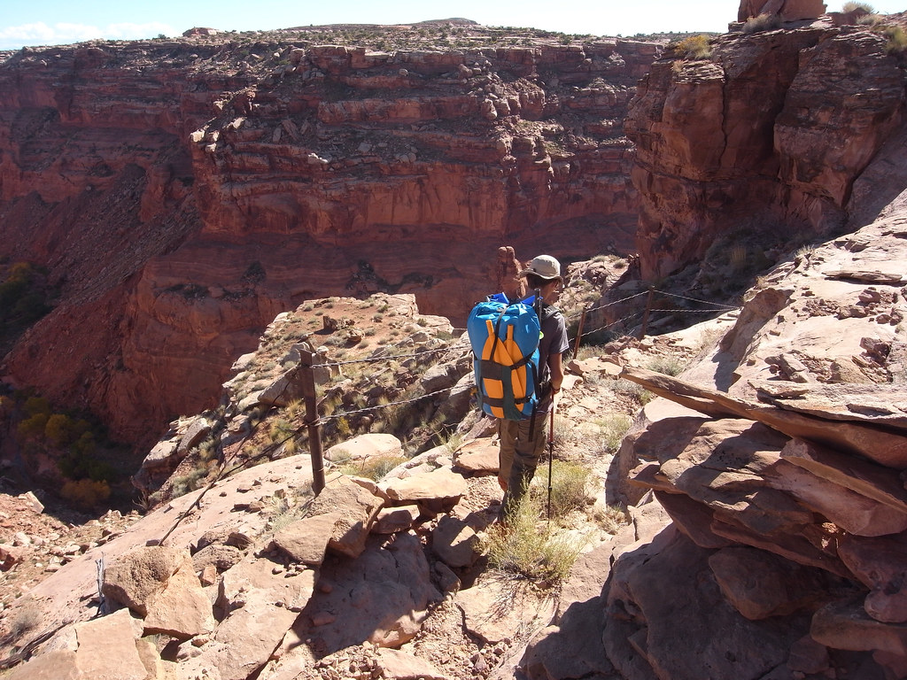
A bright clear morning on day 2 was ideal for a loop hike into the Maze involving the super fun descent down from the Overlook, the ridge near Pete’s Mesa, Chimney Rock and Pictograph Canyon. 13 miles later, with fresh water from the abundant springs in the canyons I was back at camp for a modest lunch and nap, then relocated my camp to the top of the Golden Stairs, with its far ranging views of the Fins, Ernie’s Country and the benches ultimately leading to Hite.


The third and last day started with mare’s tails, strong gusts and shortly followed by building darkness to the west. Ahead of me I had a long cruise back to the boat, but hoping for at least partial tailwinds I decided to spend a few hours first descending the Golden Stairs trail and visiting Lou’s spring on the outskirts of the complex Fins area. Unable to completely relax, with an eye constantly to the sky, I rushed this amazing hike leading to an area worthy of many days.


Back up I cleared out before 11 and pedaled non stop for 3.5 hours to arrive at the Green in complete overcast, ominous conditions. Relieved to find the raft not absolutely destroyed by pack rats (a worry that stressed me out most of the ride back!!) I recrossed the river and rode the White Rim back to the car. That evening it rained hard over the entire region. Over the span of three days I saw just two jolly backpackers at the Harvest Scene.


For full disclosure I should remark that although I secured a permit for this trip, I was later contacted by the NPS and told that it is illegal to move a bike on the river. Whether this obscure rule is in fact in the regulation book or merely a misinterpretation by an office bound ranger remain to be discovered


All photos with a GoPro Hero 2.


A minor defile below the Buttes of the Cross


Rock shelter bivy


Water in the desert!!!


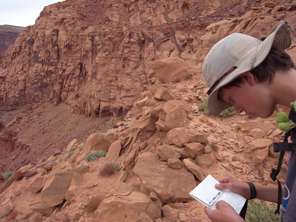
If there’s a cairn there’s probably a way.


Moki steps


More fun Maze mazing.


This catwalk would have freaked me out with a heavy pack along.


The incredible Lou’s spring, unfortunately marred by the bizarre tragedy of last year. Thankfully I had forgot about it until returning.


Golden Stairs tarp camp.


The bike, a Surly Krampus. Socalled mid fat technology.


Golden Stairs trail, a hard to follow jumble of broken rock and debris zig zagging down thru layers of sandstone. On the map marked as 1.3 miles but gps’ed at 2.2


China Neck


Yes that little thing of a mere 5 lbs can haul a full size mtb and do class 4 (with an optional spray deck)

millard canyon to horsethief, via packraft and backpacking

Zooming along the White Rim looking for a suitable launch.

Devil’s Slide to Horsethief Canyon; a packraft loop 

In October 2014, we managed to squeeze in an overnight trip with Bjorn this weekend. We started by leaving the car at the top of the Mineral Bottom switchbacks and pedaling down to the White Rim. After a while we stashed the bikes and paddled our packrafts down to Millard Bottom. This took most of the morning, as it’s a good 16 river miles to cover that stretch. The current is slow at this time of the year so we saw it necessary to paddle strongly to maintain a 4 knot average.

After lunch we hiked up the big dry wash of Millard Canyon, an impressively vast drainage that covers a lot of ground clear up to near Hans Flat. All over the territory featured on this trip there were evidence of recent huge flash floods scouring clean the canyons, and even forming big deltas in flatter areas not normally affected. Washes as wide as 100′ or more had signs of 4′ of flood water.
Anyhow, our goal in Millard was to find the side canyon containing the old Devil’s Slide trail. Using Kelsey’s customarily excellent info we easily navigated from the river to the base of this elusive feature in 2 hours time. The big climb itself is on a very old and barely existing cattle route up a formidable Wingate wall. It took a fair bit of attention to stay at or near the actual path, and various sections were quite eroded and therefore exposed to significant drops. The top out is marked by an old well drill fitting sitting on the edge of the rim, but have otherwise no trail or cairns leading to it. It would be tough to locate the trail from this angle.
After hiking across the mostly featureless expanse of the Lower Spur for some miles we found an appealing canyon rim to camp on. Having not seen any water since the river we were glad to have the couple of gallons we had lugged up here. By the time a moonless night took over the mid was up and a dinner of bagged salmon and cous-cous brewing.
Next morning’s first stage was to find the head of Horsethief Canyon and the cattle trail leading down. Not exceedingly difficult, but we did wander the rim a bit longer than needed because it was exhilarating as always to play around the sudden shift from horizontal to vertical. Once down in bottom via the faint old trail we came across the first water since the river in the form of a very generous spring source filling and over flowing sandy pools in a flood ravaged canyon.
This Wingate defile is a long one. From the narrow, verdant and shady upper reaches to the open sun baked slog of the endless lower canyon it seems like most of the day was spent on this portion our adventure. Again we marveled at the violence of the September floods, cutting ten foot banks out of sand deposits and uprooting mature cottonwoods. Around mid afternoon the appearing mudflats of a receding river prompted us to inflate our packrafts and drag them behind us the last stretch. A firm substrate a foot down below the clay slip allowed us to do this.
Crossing the Green was simple, but gaining a landfall on the opposite side was near epic. Negotiating the collapsing steep bank from sitting in a squirrelly packraft in swift current, to hacking our way into impenetrable tamarisk thickets provided some of most fun we had that day, seeing us moving the very short distance from river to White Rim road in maybe 45 minutes.
All that was left then was to locate our bikes and ride up the Mineral switchbacks to the car.


Paddling the Green on the way to Millard Bottom


Bjorn playing in an eddy before packing up and starting the backpacking portion of our trip.


The expansive drainage of Millard Canyon stretching out behind Bjorn. Cleopatre’s Chair in the distance.


Approaching the wall containing the Devil’s Slide trail. At this point we had no idea where it ran.


Checking the copy we did from Kelsey’s book midway up the trail.


Camp on the edge of unnamed side canyon to the Green.


Surveying the monotone expanse of the Spur before heading out to find the head of Horsethief Canyon.


Looking into Horsethief.


The well defined upper beginning of the trail into Horsethief. Soon hereafter it deteriorated into loose rubble and erosion.


Flood damage in upper Horsethief.


Lower Horsethief.


Getting real close to the Green.


Readying for the 2 minute paddle across the river.


Trying to gain a hold on the White Rim side of the river, so we could fetch our bikes and ride back to the car.


Bjorn changing into the climbing gear on his dingle speed, before attempting the Mineral climb.